tnmservices

Contact Us

by Capt Chatan Malhotra | Operations Manager


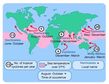
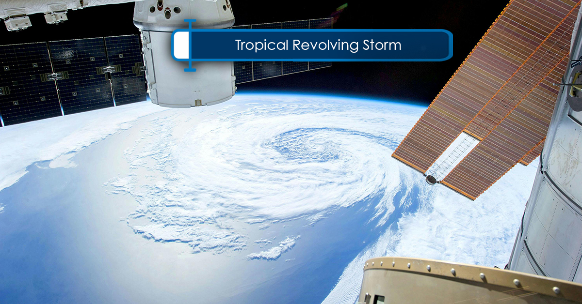
Tropical Revolving Storm is an intense rotating depression (a region of low pressure at the surface) which develops over the tropical oceans. It consists of a rotating mass of warm and humid air and creates  strong winds, thunderstorm , heavy rains, very heavy seas and swell  etc.

Some of the important characteristics of a Tropical Revolving Storm (TRS) are:

  • They appear smaller size than temperate depressions
  • They form near the Inter Tropical Convergence Zone, a zone of instability
  • They have nearly circular isobars
  • No fronts occur (a front is the boundary between two air masses, often distorted by warmer air bulging into the colder air)
  • They result in a very steep pressure gradient
  • They have great intensity

Warning Signs for a TRS

  1. Electronic Medium
      • The Radio/Telex/NAVTEX – A relevant NavArea must be selected for the message.
    • EGC- Via Sat- C normally.
    • Internet based options- If vessel is equipped with internet facility then such phenomena can be checked 7-8 days in advance through various government operated sites.
    • Weather Routing agencies – With dedicated team for the TRS / Storm watch and have multiple data from reliable sources who can make a better and accurate assessment of the forecast with suggestion to avoid the TRS.
  2. Swell
    When there is no sight of intervening land, the sea might generate swell within a TRS, indicating an early warning of the formation of the same, the swell normally travels as far as 500 nm from the center of the storm eye. Normally, the swell travels outward from the direction of the storm.
  3. Atmospheric pressure
    If the corrected barometer reading falls below 5 mb or more for the mean reading( Information from Sailing Direction) for that time of the year, you can expect a (Tropical Revolving Storm) TRS and fall is pressure by 20 mb means vessel is very close to the eye of the storm. The barometer used must be corrected for latitude, height, temperature etc. to achieve maximum possible accuracy and efficiency.
  4. Wind
    Wind direction and speed is generally fairly constant in the tropics.
    Variation from the normal direction for the area and season, and increasing wind speed, are indications of the approach of a Tropical Revolving Storm, i.e., an appreciable change in the direction or strength of the wind indicates a Tropical Revolving Storm (TRS) in vicinity.
  5. Clouds
    A very candid and colorful sky at sunrise and sunset may be a sign of a brewing TRS. Presence of cirrus clouds is visible at a considerable distance of 300 to 600 miles from the TRS and as you approach the TRS, the Cirrus cloud can be in the form of strands or filaments with aligned conditions and points towards the storm center. Generally followed by cumulus clouds as you get closer to the Tropical Revolving Storm (TRS).

    • Semi circles: A TRS is divided in 2 parts, which are,
      • Right-hand semicircle (RHSC): It is the imaginary half of the storm, which lies to the right of the observer, who faces along( Same Direction)  the route of the storm. For a stationary observer, here the wind veers steadily.
      • Left-hand semicircle (LHSC): It is the half of the storm, which lies to the left of the observer, who faces along the route of the storm. For a stationary observer, here the wind backs steadily.


The Semicircles

Navigable semicircle — It is the side of a tropical cyclone, which lies to the left of observer in the direction of movement of the storm in the Northern hemisphere (to the right of the observer in the Southern Hemisphere), where the winds are weaker and better for the navigation purpose, although all parts of TRS are more or less dangerous to mariners , at least 100 nm should be maintained in this Semicircle to avoid severe damages to vessel caused by the high sea & swells.

Dangerous semicircle— It is the side of a tropical cyclone, which lies to the right of the observer of the direction of movement of the storm in the Northern Hemisphere (to the left of the observer in the Southern Hemisphere), where the storm has the strongest winds and heavy seas, at least 180-200 nm of distance should be maintained to avoid severe damages to the vessel caused by the high seas & swells